
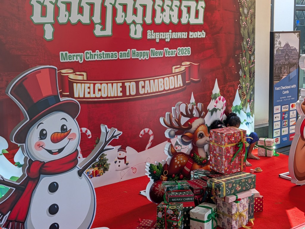
On New Year’s Day 2026 we tuktukked to the visitor center at Angkor Archaeological Part, got our three-day passes, admired the Christmas decorations, and then headed into the park for our first look at the ruins. The first day focused on Angkor Thom, the remains of the former capital city of the Khmer Empire. (Angkor Thom is the abandoned capital, Angkor Wat is the giant temple complex outside the city, which comes tomorrow.)
Here’s how Zhou Daguan described it in 1296:
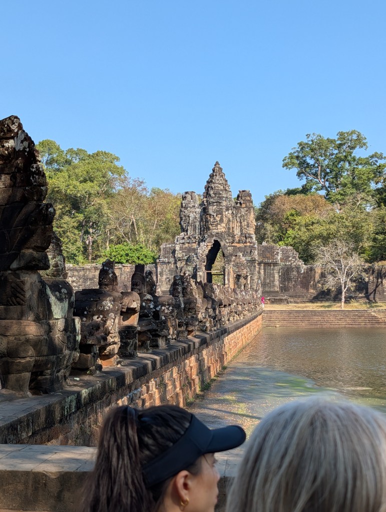
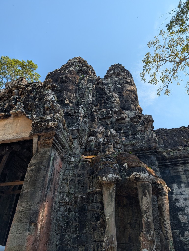
“The walls of the city [Angkor Thom] are about twenty li [about 7 miles or 10 kilometers] in circumference. There are five gateways, each of them with two gates, one in front of the other. There are two gateways facing east, and one gateway facing in each of the other directions. Around the outside of the city walls there is a very large moat. This is spanned by big bridges carrying large roads into the city. On either side of every bridge there are fifty-four stone deities. They look like stone generals, huge and fierce-looking. The five gateways are all alike. The parapets of the bridges are all made of stone and carved into the shape of snakes, each snake with nine heads. The fifty-four deities are all pulling at the snake with their hands, and look as if they are preventing it from escaping. Above the gateways in the city wall there are five stone Buddha heads. Four of them face toward the four cardinal points, and one of them is placed in the middle. It is decorated with gold. On either side of the gates the stones are carved into the shape of elephants.
“The walls are all made of piled-up stones, and are about twenty-one feet high. The stones are very tightly packed and firm, so there are no weeds growing. There are no battlements either. Here and there sugar palms have been planted on the walls, and there are empty chambers at frequent intervals. The inside of the walls is built like a slope, and is probably over a hundred feet in width. The slopes all have big gates on them that shut at night and open early in the day. There are guards, too, though only dogs are not allowed in — and also criminals who have had their toes amputated. The city walls form an exact square, with a stone tower on each of its four sides.”
And here’s how it looked when Henri Mouhot visited the site in 1858:
“Half a mile beyond Bakheng are the ruins of Ongkor-Thom. A partly-destroyed road, hidden by thick layers of sand and dust, and crossing a large ditch, half filled with blocks of stone, portions of columns, and fragments of sculptured lions and elephants, leads to the gateway of the town, which is built in the style of a triumphal arch.
“These remains are in a tolerable state of preservation, and are composed of a central tower, 18 metres high, surrounded by four turrets, and flanked by two other towers connected together by galleries. At the top are four immense heads in the Egyptian style; and every available space is filled with sculpture. At the foot of the great tower is a passage for carriages; and on each side of it are doors and staircases communicating with the walls, the whole building being constructed of sandstone. The outer wall is composed of blocks of ferruginous stone, and extends right and left from the entrance. It is about 24 miles square,* 3 met. 80 centimet. thick, and 7 met. high, and serves as a support to a glacis which rises almost from the top. At the four cardinal points are doors, there being two on the east side. Within this vast enclosure, now covered with an almost impenetrable forest, are a vast number of buildings, more or less in ruin, which testify to the ancient splendour of the town.”
In 2026 Angkor Thom is kind of mid-way between what Master Zhou saw and what M. Mouhot described. The “impenetrable forest” has mostly been cleared away, or at least reduced to park-like shade trees with expanses of grass, trails, and some paved roads to allow access to the ruins. There aren’t tigers any more. But the buildings are still ruins, although efforts are underway to stabilize them. Here and there some reconstruction work has been done — the moat which was dry and full of broken columns and sculpture in 1858 has been cleared out and filled with water again, and the five bridges have been restored to something like what Master Zhou described, with Naga sculptures protecting the city from evil influences. I don’t know if that was done during the French colonial era or by the modern Cambodian government.
I don’t think you need all your toes to be allowed inside any more.
Our tour group was accompanied by one of the Archaeological Park guides, Mr. Saom. I managed to ride in the same the tuk-tuk with him on the way from the visitor center to the south gate of the city, and questioned him as much as our ability to understand each other permitted.
At its peak, Angkor was a major city, with a population of 100,000 to 1 million people, depending on how you define the city and whose estimates you follow. The square walled city of Angkor Thom was the center of a much bigger conurbation sprawling across nearly a thousand square kilometers. I expect the low number is for the population inside the walls and the high number represents the Greater Angkor Metro Area. For perspective, London in 1296 had about the same population as Angkor Thom proper, without the enormous suburbs.
Angkor Thom was divided up into 54 neighborhoods, or wards, each of which was home to a different clan or tribal group. A quarter of the city was devoted to the complex of palaces and temples where the Khmer emperors lived.
The five gates each had a primary function. The south gate was for merchants, the west gate was for the dead, the north gate for priests (I think), and the two eastern gates were the Way of Victory (used when the army set out on campaign and when they returned triumphant) and the Way of Death (for when they came home defeated). I have a suspicion that most people just used whichever gate was in the direction they wanted to go, since hiking a couple of miles out of your way seems like an immense bother.
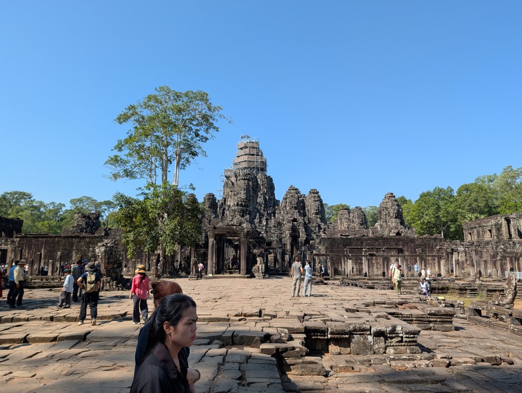
We disembarked from our tuk-tuks at the south gate like merchants, and walked into Angkor Thom, eventually reaching the big temple at the exact center of the city, called Wat Bayon. It covers about four city blocks, and follows the standard pattern of Hindu/Buddhist temples in Indochina, with a tall tower in the center surrounded by a square gallery with towers on the corners and smaller towers at the four gates. The layout represents Mount Meru, the mountain at the center of the world in Buddhist cosmology.
Seven hundred years ago Zhou Daguan described it this way: “In the center of the capital is a gold tower [Bayon], flanked by twenty or so stone towers and a hundred or so stone chambers. To the east of it is a golden bridge flanked by two gold lions, one on the left and one on the right. Eight gold Buddhas are laid out in a row at the lowest level of stone chambers.”
Today the gold is all gone, as are the lions. But the giant sculpted Buddha faces on the central tower still smile serenely at the cardinal points. We clambered around the temple and took pictures. While it is certainly in a ruinous state, I can’t call Wat Bayon a ruin in the strict sense of the term, because it is still an active Buddhist temple. We saw incense sticks and offerings at the central tower. Tourists were advised to dress appropriately — no bare shoulders, skirts below the knee. Since my invariable travel wear is long pants and a collared shirt with the sleeves rolled up, I was fine. (I recommend that ensemble to travelers of both sexes almost anywhere — you can go from hiking a jungle trail to visiting a religious building to dining at a nice restaurant with no change beyond taking off your hat. Plus you don’t look like a dork.)
After Wat Bayon we passed by the Terrace of the Elephants (one of the few bits of the old royal palace still in good shape) and stopped to look at the Gate of Victory on our way out of the city center. I believe that’s the one M. Mouhot described as being “in the style of a triumphal arch.”
We stopped for a brief look at the Ta Nai temple (a smaller temple east of Angkor Thom which didn’t have a lot of other visitors) and then had lunch at a restaurant nearby. I don’t recall what we had — I think all of us in the group would have been as satisfied with some sandwiches in a Baggie as eating a sit-down meal took up time we could have spent at the temples and ruins.
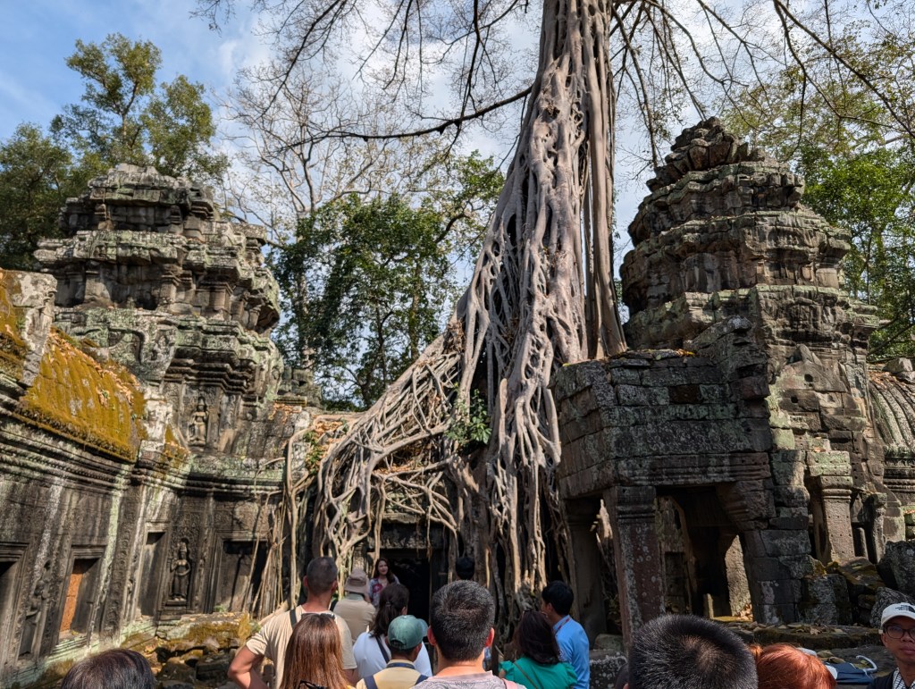
After lunch we walked across the street to the Ta Prohm temple, also known as the “Tomb Raider temple” because it was used as a filming location for the 2001 movie with Angelina Jolie. It is believed to be the memorial temple for the mother of one of Angkor’s kings, and the site is particularly striking-looking because of the way some trees (banyans, I think?) have grown into the stone structure of the temple. I don’t know what will happen when those trees die — will the temple fall down? I assume (hope) that someone at the Archaeological Park has a plan for what to do in that case.
Then back into Siem Reap for an afternoon break at the hotel. I had a dip in the pool and then got cleaned up and dressed for our evening activity: a street food tour of Siem Reap!
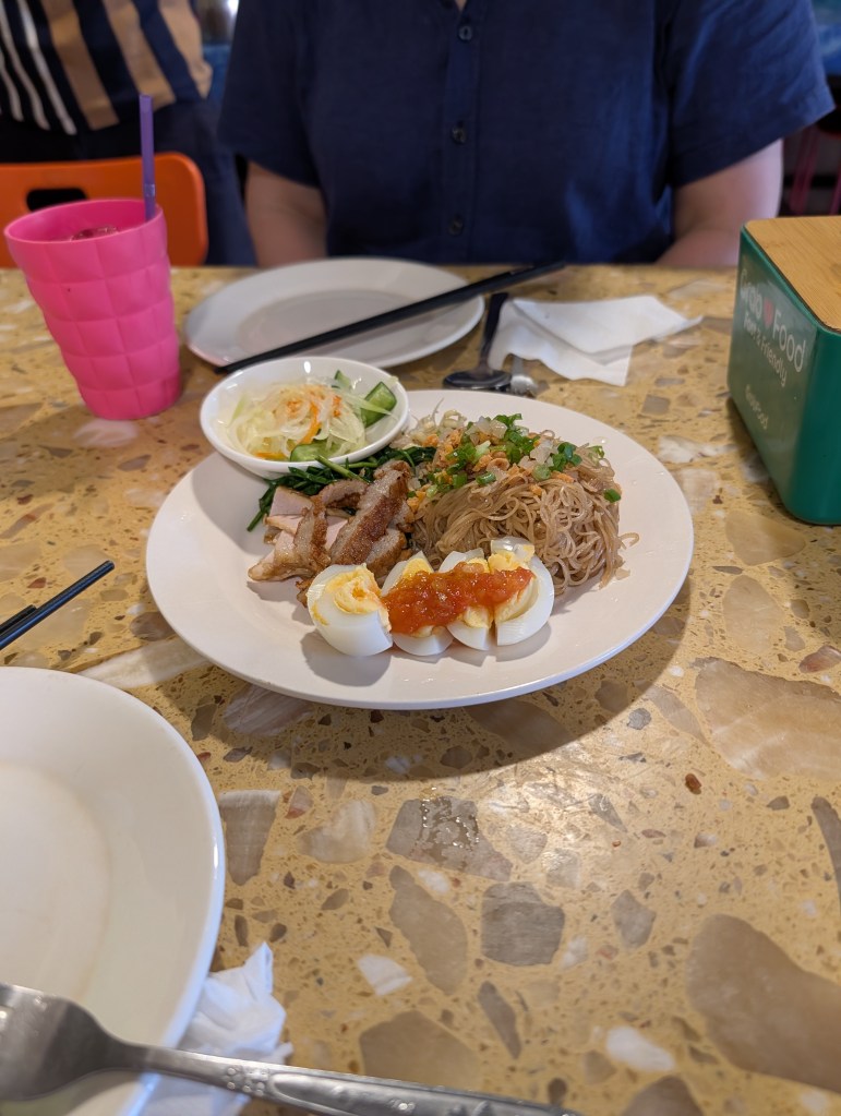
Our first stop was at a noodle shop called Mikola Noodles for, well, some Mikola noodles, a specialty of a Cambodian ethnic group called the Kola. Nice noodles, but not a moment to spare! We got back into the tuk-tuks and rode south into rice-paddy country to watch the sunset. A group of farmers were having a backyard party nearby, and we stumbled across some water buffalo grazing in a pasture.
From there we continued on to a tiny farming village (SOPI = 3) for dinner with a farmer named Mr. Wet. His house has two rooms, very little furniture, and stands on stilts next to his rice field. We had some nice minced pork with fermented fish, a chicken dish, and a fish dish, all accompanied by elegant little cones of rice wrapped in banana leaves. Just as the default Italian recipe is “braise it in tomato sauce and serve over pasta” the default Cambodian recipe is “braise it in coconut milk with aromatics and serve over rice.” Both methods produce reliably good results.
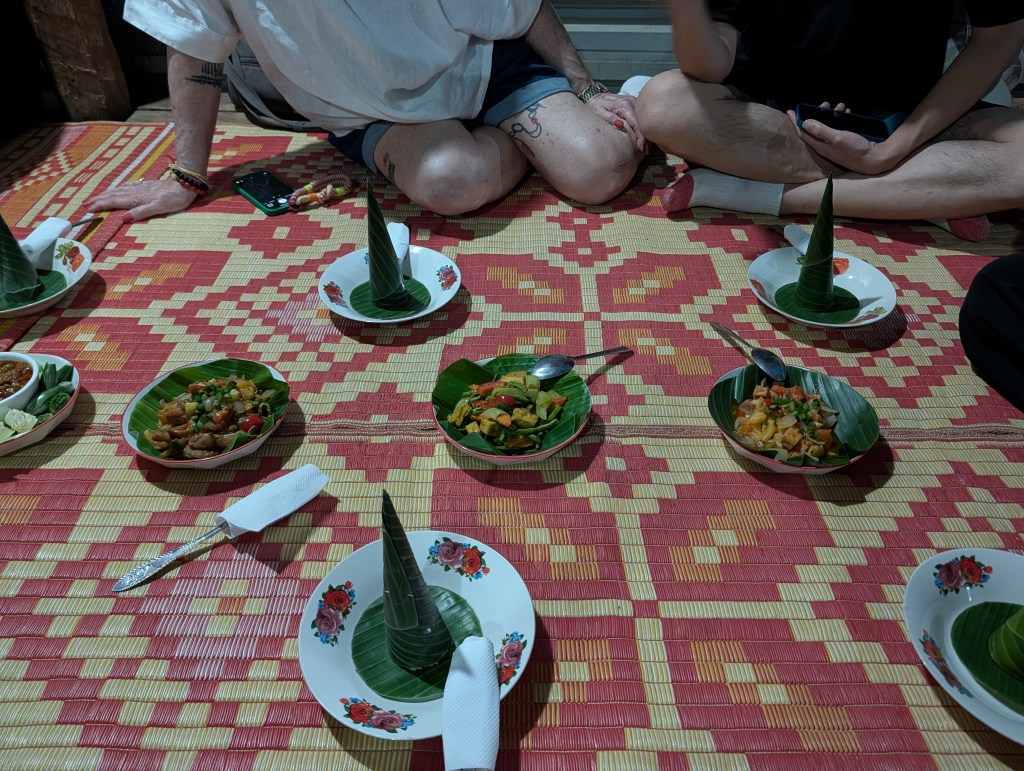
Given the way Mr. Wet’s neighbors were completely uninterested in eight foreigners descending on their village I wasn’t surprised to learn that he has a standing arrangement with the tour company to serve authentic home cooking to visitors.
Still not done! Back aboard the tuk-tuks and north in the deepening night back to Siem Reap for barbecue beef skewers (which were excellent), and some barbecued tripe across the street (also excellent), finally wrapping up with banana roti (essentially banana and chocolate crepes) from a cart in the middle of the night life district.
We finished the night with some craft cocktails at a fancy bar, and then off to bed, tired from a long day and absolutely stuffed.
*I think either M. Mouhot or his translator dropped a decimal point here. Angkor Thom isn’t 24 miles square, or even 24 kilometers, but it might be 2.4 kilometers on a side depending on how you’re measuring it and how good your equipment is.

One response to “The Great Indochina Expedition, Episode 6: Angkor at Last!”
[…] Next time: Angkor! […]
LikeLike